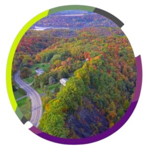
Greenways and blueways are corridors of open space or waterways that incorporate diverse natural, cultural, and scenic features.
Vision: Onondaga County will protect and expand greenways and blueways to provide unique recreation and ecological health opportunities.
Naturally Connected: Countywide Greenways + Blueways Plan
Onondaga County is undertaking a comprehensive planning effort to develop a countywide Greenways and Blueways Development Plan titled Naturally Connected Onondaga: Countywide Greenways + Blueways Plan. Building on the foundation established in Plan Onondaga, this initiative will create a strategic framework for an interconnected network of conservation greenways, mobility corridors, recreation greenways, agricultural corridors, and blueways across the County. The plan aims to strengthen connections among people, communities, and ecological systems while enhancing environmental resilience, community connectivity, and overall quality of life.
The project will entail:
- refining the bluewayand greenway typologies established in Plan Onondaga
- conducting a comprehensive inventory and analysis of existing conditions
- developing a vision and implementation strategy
- identifyingpriority projects with cost estimates and funding sources
- creating a municipal toolkit with resources for implementation and maintenance
- engaging with stakeholders and the public throughout the process.
The consulting team led by Colliers Engineering & Design is assisting the County with this process, which will result in a master plan document with detailed project profiles, design guidelines, funding strategies, and community engagement materials to position Onondaga County for successful implementation of this integrated greenway and blueway network.
Project Schedule:

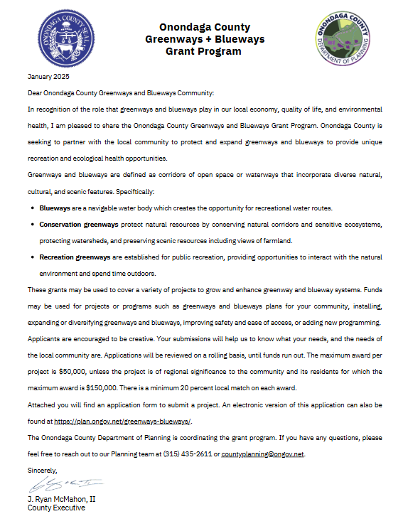
Onondaga County Greenways + Blueways Grant Program:
In recognition of the role that greenways and blueways play in our local economy, quality of life, and environmental health, County Executive J. Ryan McMahon, II is pleased to share the Onondaga County Greenways and Blueways Grant Program. Onondaga County is seeking to partner with the local community to protect and expand greenways and blueways to provide unique recreation and ecological health opportunities.
Applications are accepted on a rolling basis.
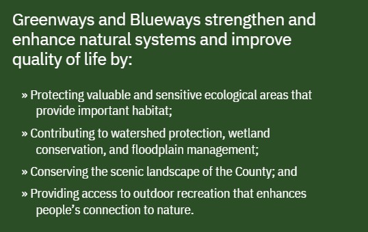
System Components: Greenways and blueways work together to provide a connected system of recreation and conservation lands.
Greenways + Blueways Goals and Strategies
The County aims to establish a formal, countywide Greenway and Blueway System through targeted planning. Achieving this vision will require collaboration among stakeholders from urban, suburban, and rural communities, including existing friends groups and stewardship organizations. The County can serve as a catalyst—leading coordination efforts and providing tools and resources to support implementation.
Strategy 1: Develop a Greenway and Blueway Plan that identifies specific targets for preservation and active recreation.
Strategy 2: Conduct a Natural Resources Inventory to identify critical and vulnerable assets, and a means to communicate information to community partners and the development community.
Strategy 3: Develop a policy and planning toolbox to share with municipal partners, to conserve greenway environments, promote open space protection, and foster implementation of compatible zoning and development regulations and guidance.
Strategy 4: Facilitate ad hoc coordination of greenway and blueway related activities.
Completing trail networks like the Onondaga County Loop the Lake Trail and the Onondaga Creekwalk remains a high priority. The Empire State Trail Local Economic Opportunities Plan (LEOP) highlights several potential connections between the east-west Empire State Trail (EST) and nearby communities. Ongoing investment in trail connectivity is key to expanding recreation and tourism opportunities and enhancing quality of life for residents. Additionally, potential north-south routes linking northern suburbs with southern agricultural tourism areas should be explored.
Strategy 1: Construct the remaining portions of the Loop the Lake and Onondaga Creekwalk trails.
Strategy 2: Develop a Countywide multi-use trail and active transportation network plan building off of the LEOP.
Strategy 3: Develop and implement a wayfinding system for existing and newly constructed trails, including connections to and from community destinations.
Strategy 4: Expand microtransit options and other safety and comfort features on trials.
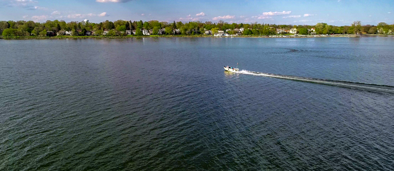
Onondaga County is rich in water-based recreation opportunities. It straddles two major continental watersheds—the Great Lakes and the Susquehanna River—and includes the two easternmost lakes in the Finger Lakes watershed. The original Erie Canal and the New York State Barge Canal cross the County, linking local waterways to the Great Lakes, Hudson River, Atlantic Ocean, and even the Mississippi River and Gulf of Mexico.
While water transportation is possible—connecting downtown Syracuse to many northern parts of the County—it remains underutilized due to limited promotion and investment in infrastructure. Establishing a formal Blueway system would expand access to these waterways for a range of users. While Blueway trails often focus on non-motorized recreation, planning in Onondaga County should also consider resources to support motorized watercraft, given the scale and potential of the system.
Strategy 1: Create a countywide Blueway Plan, working with NYS DOS Coastal Resources in order to plan for the development of blueway amenities and resources such as fishing access, swimming, boating, wildlife viewing areas, and other shoreline features such as restaurant and entertainment facilities and trail connections.
Strategy 2: Plan for and invest in landside trail connectivity between blueways, local communities, and shoreline destinations.
Conservation of important habitats and corridors within the County will be an important component of establishing a Greenway and Blueway system. The County can assist in preservation efforts by developing mapping resources, providing model planning and zoning tools, supporting land- trusts, and acquiring land and easements.
Strategy 1: Identify and map sensitive areas within the County where future development should be limited.
Strategy 2: Identify and conserve important natural corridors to limit habitat fragmentation.
Strategy 3: Develop model planning and zoning tools such as buffering, conservation subdivisions, and open space zoning to protect open space systems.
Strategy 4: Provide support for land trust efforts to protect local habitats, open spaces, and shorelines.
Strategy 5: Utilize land acquisition and develop easements to protect critical environmental resources.